Sailing from A to B = Course and Distance.
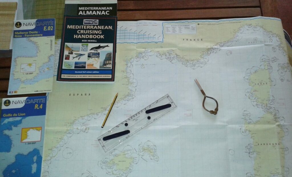
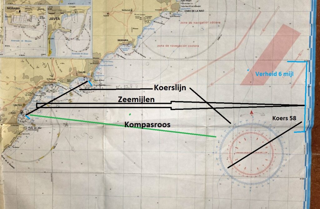
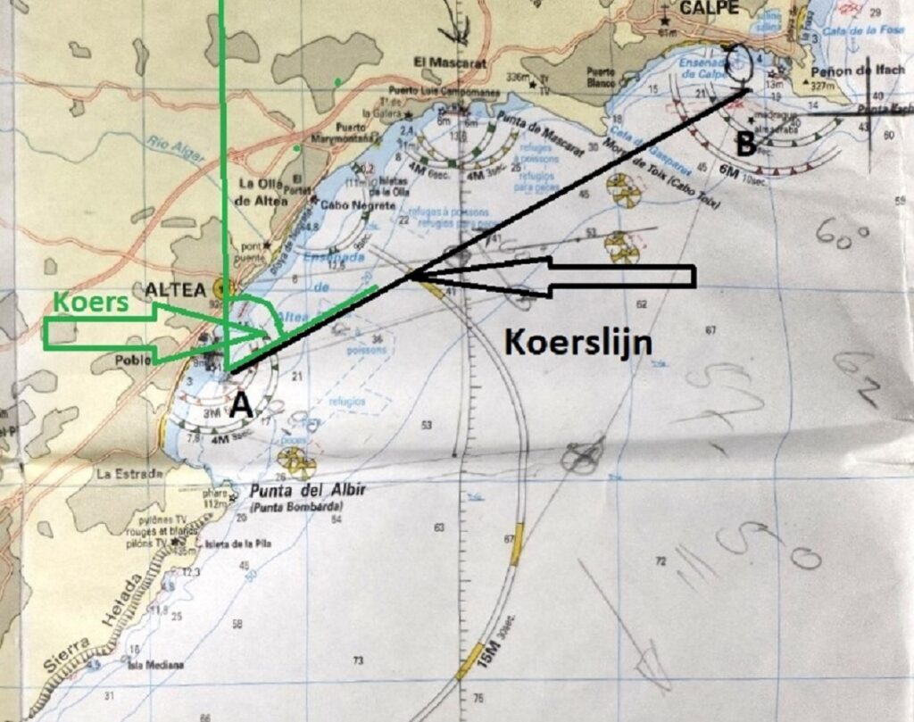
Traditionally there have been maps to get from A to B by sea. On these maps you can use so-called card passes to find out which direction (course) you should go, how far it is (verheid) and, based on your speed, calculate when you will arrive in B As an example of card passes, take a trip from Altea (A) to Calpe (B). We can read the course by shifting the course to the compass rose with the parallel ruler. The distance with the compass on the side of the map where one minute in width is one nautical mile.
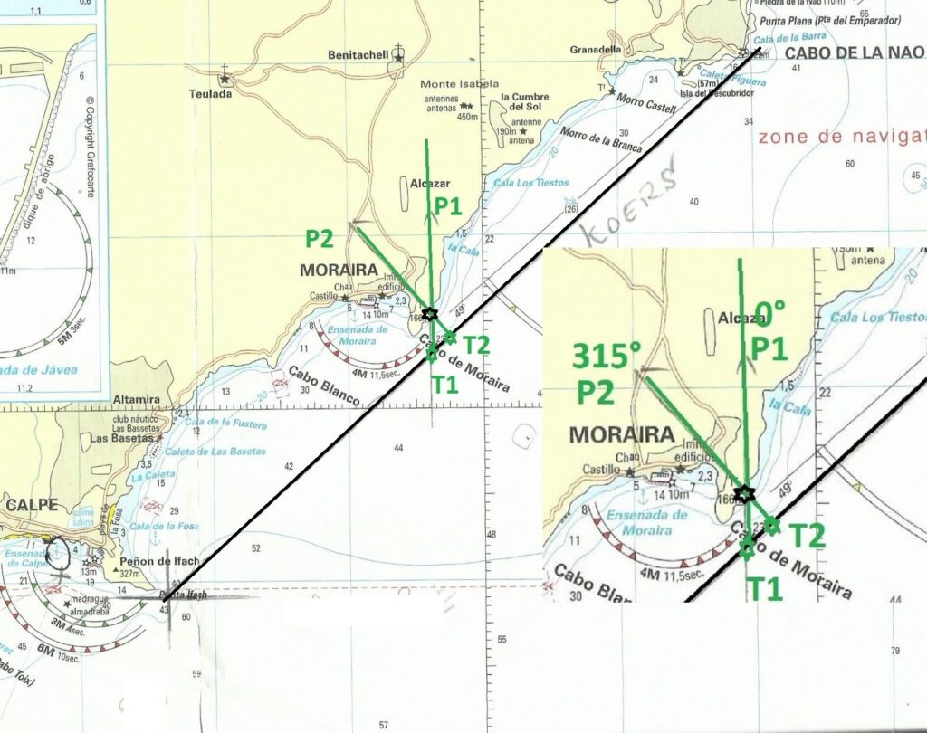
The 4-region poll
A simple way to determine the distance of that object such as a cape or lighthouse when passing an object is the 4-point bearing. A compass rose has 360 degrees and in the navigation world 32 points, 8 per quadrant. We sail from Calpe to Cabo de la Nao passing a tower on the cape at Moraira and our course 45°. We record the time when we have the tower at 4 points, that is when we gauge the tower at 0°. We record a second time when we reach the tower perpendicular to our course at 2 points and that is at 8°. The distance traveled between the 315 points in time is the distance to the tower. The 2 sides of a right-angled triangle.
The geographic and magnetic North.
In the foregoing we have ignored the situation where we only have access to the magnetic compass, for example with no electricity and therefore no information from satellite etc. The magnetic field of the Earth does not correspond to the (geographical) north and south poles, which we have determined by the axis around which the earth itself rotates, the magnetic north and south poles are slightly removed from it and change. This means that the direction in which the magnetic compass points north may differ from the true direction north. This difference is called variation and can be either plus or minus. In addition, the iron present in ships also causes a deviation and that difference is called deviation and can also be plus or minus. The result of the two deviations is called the error. The variation depends on the location on Earth, can be found in the compass rose on the sea chart and has changed over time. In the Mediterranean area there is currently very little variation, the change per year is also shown on the map
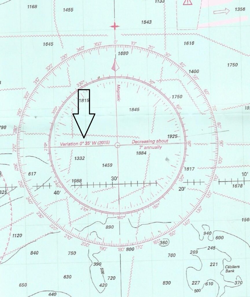
The sign, plus or minus, is sometimes indicated, sometimes it is indicated with the indication west or east and you apply west minus, east plus. The deviation depends on the direction in which the ship is moored (course). On polyester ships this rejection will be nil, provided there is no screwdriver or set of keys near the compass. On iron ships, the deviation is determined by turning the ship 360 degrees on a so-called compass pole and determining the deviation based on fixed points on shore.